As the Remote Sensing Specialist for the Beaver Lab at Collaborative Earth, I am responsible for creating the data workflow and pipeline to model the impacts of beaver dams. Specifically, I designed and developed a user-friendly web application that allows conservationist or land owners to assess the ecological effects of beaver dams on local landscapes. I did this by integrating automated Python and Google Earth Engine workflows to extract pixel-level spectral indices (NDVI, NDWI, EVI, LST) and terrain metrics across thousands of sites.
In this role, I direct project management, GitHub coordination, and cross-institutional collaboration, boosting output quality and accelerating delivery timelines
To access the web application, navigate to https://ilovebeaver.streamlit.app/Exportspage or click the button here —->
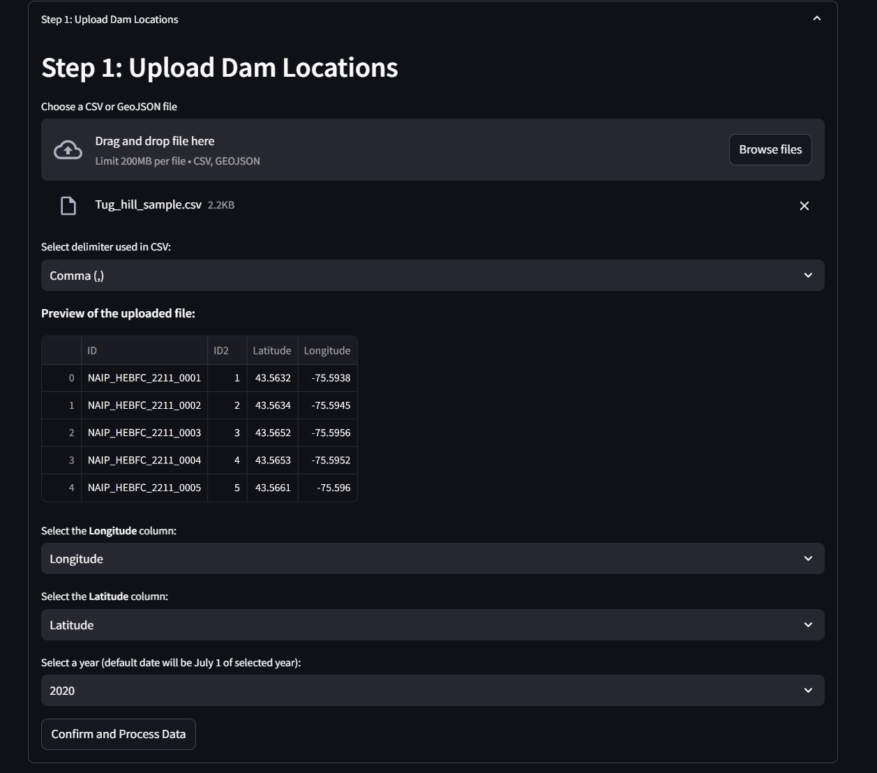
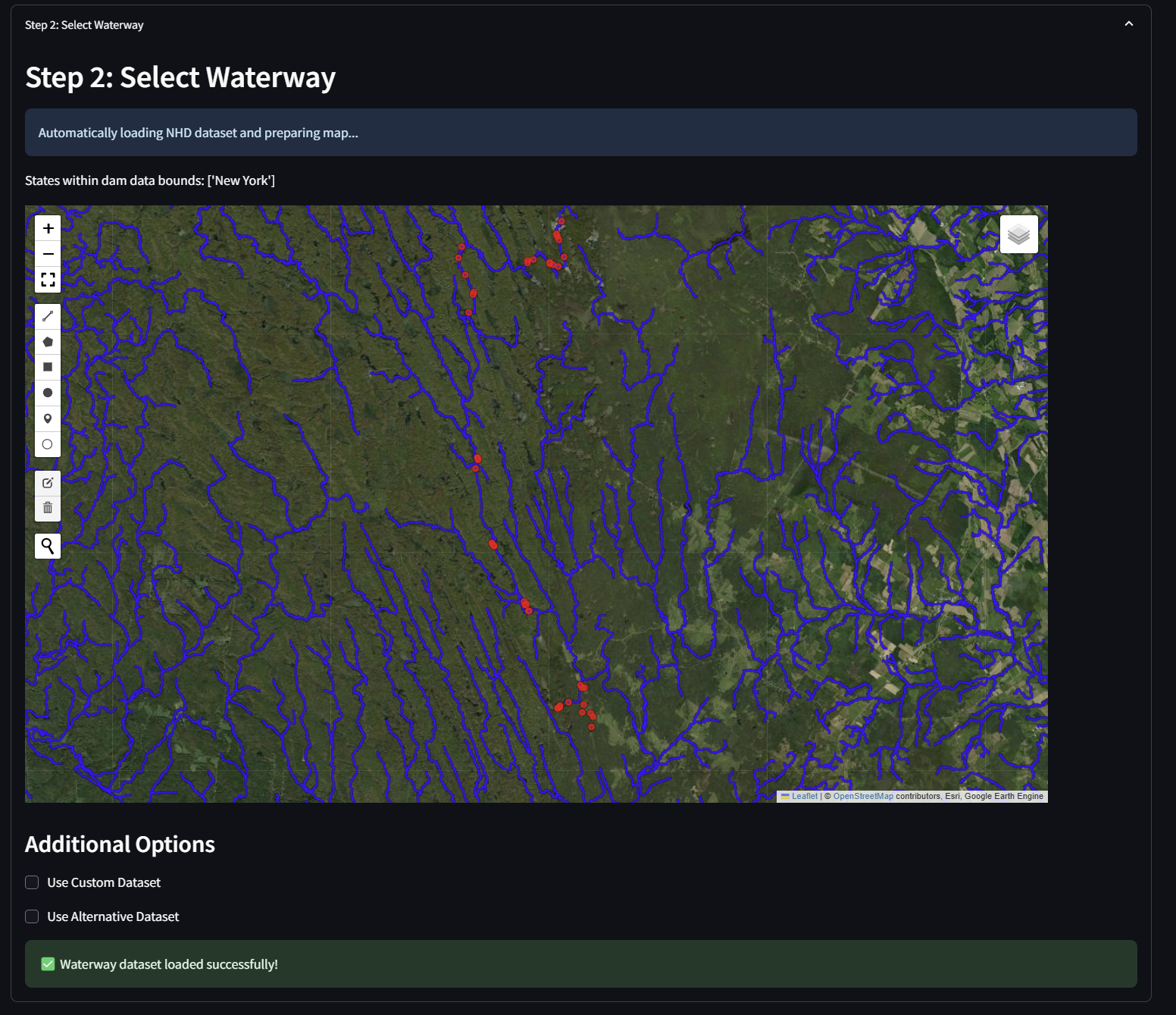
Below is a general workflow for the webapp:


Below is an example of the output of my algorithm that creates upstream/downstream elevation masks to sample only the relevant wetland area around the dam, and separate by flow direction!
