Evaluating Multi-Temporal Optical and Radar Images for Crop Area Mapping in the US
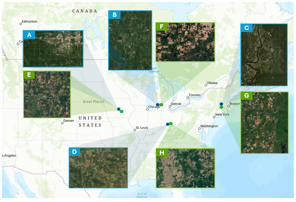
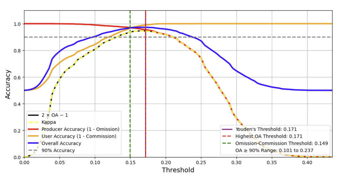
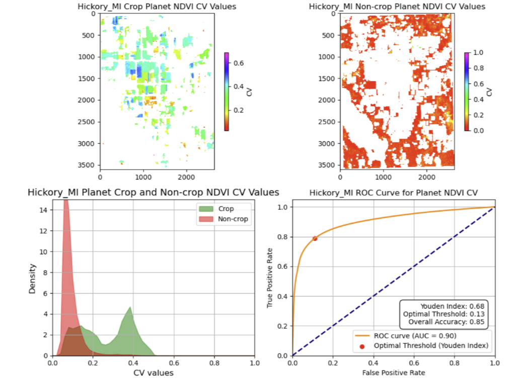
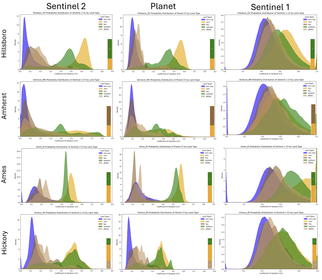
Thesis in progress- example figures below:
Evaluating Multi-Temporal Optical and Radar Images for Crop Area Mapping in the US
Thesis in progress- example figures below: